Now there’s a big philosophical question to headline a blog. Tempting though it is to launch into a bout of critical self-reflection about my life choices, this is less about the paths I have taken in life and much more about how I make decisions about what location I am going to on any given day. How do I organise the locations I go to? What things do I consider before deciding where to head? How do I organise all the information to help me make those decisions? Well, that’s what this post is about. So, not quite mid-life crisis levels yet…
I haven’t got a huge selection of locations that I regularly visit, but there are a few recurring places that I head to that I am slowly getting to know. Each time I head to one of these locations I notice something new. Whether it’s the positioning of the sun, the different opportunities the tide brings or individual trees in woodland, there is always something different to remember for future trips. There are two main methods for recording these details, one a bit old school and one a bit more…21st century.
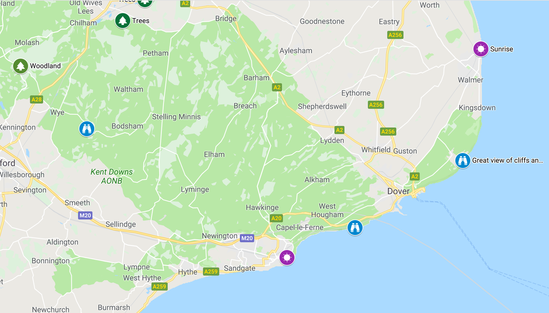
Something I have found incredibly useful is a Google Map i’ve put together highlighting some key scenes around Kent where i have found good compositions. The map features good sunrise and sunset locations, particularly good views and good spots for trees and woodland photography and also indicates the options for high and low tides. I find this really useful as at a glance it can really help me choose where to go on any given day (particularly if I can’t be bothered to explore new locations). This helps to make going out with the camera as painless as possible as I don’t have to waste huge time and energy trying to think of places to go to.
Photo location Google Map
The old school method is a notebook that I have scrawled similar details into. The notebook itself is divided up into a number of sections: seasons, sunrise, sunset and locations. Within each section there are several blank pages of spaces to enable me to note down good locations for each of the seasons, good sunrise/sunset spots and good locations in general. For each I note a load of details (again, compositions with tides, specific elements) so that it makes it quick and easy for me to find locations and I identify potential compositions quickly and easily.
My notebook with handy tabs!
Of course, the problem with these things is actually updating them (full disclosure: I soon realised upon writing this post that I hadn’t updated either in a while…d’oh). But when up-to-date, they provide a valuable resources that saves me time and frustration.
There are a number of other things I use as well to help me make decisions as to where I should go:
BBC Weather app - for the obvious information on the…er…weather, as well as sunrise/sunset times.
Photopills - a great app for sunrise and sunset, could not do without this app, it’s invaluable in plotting compositions.
MeteoEarth - this one is great for cloud cover (it also has a website as well as an app). It gives me a good indication as to what the cloud wil be like in any given location (if it indicates heavy low cloud, then I know sunrise/sunset shots are probably a write-off).
I suppose I could split these things into two groups: the recorded information to choose locations I know about, the apps etc help with new locations (as well as the familiar ones).
What about you? How do you decide where you are going to go? Do you keep notes on locations? Share your tips below!

